

You can use Google Maps to find out how much traffic lies between you and where you’re going. And starting this week, you can use the same app to find out how big a problem the coronavirus may be in that area—or anywhere else.
The company says in a blog post today that it’s added a COVID-19 layer to its Android and iOS Maps apps. The new feature shows COVID-19 case numbers and trends for many cities, as well as counties, provinces, and 220 countries around the world. You just open the app and tap on the “layers” button on the top right-hand corner of your screen, and then click on “COVID-19 info.”
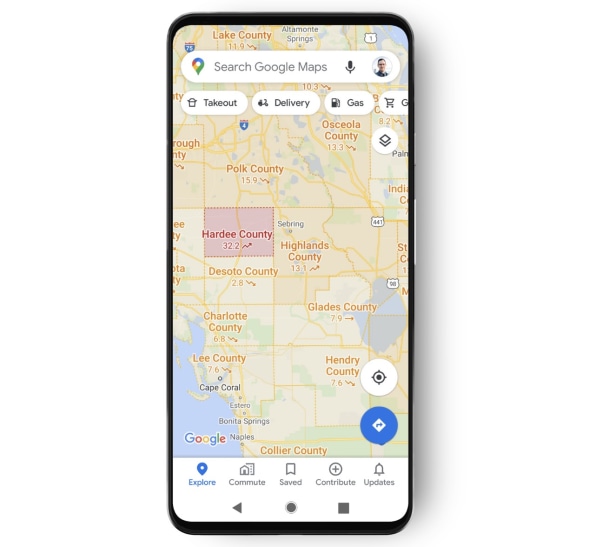
The map layer shows a seven-day average of new COVID-19 cases per 100,000 people and an arrow that shows whether the number is trending up or down. The color of the type indicates the density of the new cases in an area, Google says.
The COVID-19 data comes from sources including Johns Hopkins…
Read More…
Source : fastcompany.com
Source link
