


As wildfires rage in California, and Colorado reports the second largest wildfire in that state’s history, Google has announced it will be providing near-real-time information about such conflagrations on its search engine and mapping platform.
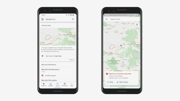
In addition to breaking news from media sources, information from local government offices, and safety tips from the Red Cross, Google will provide updated maps of the extent of fires, based on satellite data from the National Oceanic and Atmospheric Administration, and information about road closures and alternate routes. In a videoconference demonstration, Google product manager for crisis response Can Comertoglu showed how Google Maps provided directions from Glenwood Springs to Avon, Colorado, routing around a usual short route along Interstate 70, with a note that the route was affected by the ongoing fires in the area.
The company did a pilot test of the program last year around roughly five wildfires, working with agencies such as…
Read More…
Source : fastcompany.com
Source link
